Gps Survey
Advertisement
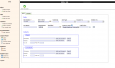
Copan for Mobile v.1.0.7
Copan for Mobile 6 is a very functional and easy-to-use geomatics engineering tool for computing and managing plane surveying and mapping coordinates. It does numerous coordinate geometry (COGO) calculations, processes and adjusts raw field survey
Advertisement
CopanMobile for PalmOS v.1.0.3
CopanMobile for Palm OS is a very functional and easy-to-use geomatics engineering tool for computing and managing plane surveying and mapping coordinates. It does numerous coordinate geometry (COGO) calculations,
IPJC v.0.5
iPJC is an easy-to-use record keeping system for the land surveying industry. It allows your staff to securely store, retrieve and cross-reference all of your company's survey database records -- of estimates, plans,
CopanMobile for PocketPC v.1.0.2
CopanMobile for Pocket PC is a very functional and easy-to-use geomatics engineering tool for computing and managing plane surveying and mapping coordinates. It does numerous coordinate geometry (COGO) calculations,
Copan Lite v.11 11
Land surveyors and civil engineers: o Calculate surveys and manage points, effortlessly o Run Copan on Windows 2K/XP/Vista/7 o Use it forever and pay nothing o Choose quadrant bearings or N/S azimuths, and gons or DMS o Create point files
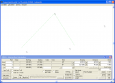
Copan for Windows v.10 9
Copan for Windows desktop/netbook is a very functional and easy-to-use geomatics engineering tool for computing and managing plane land surveying and mapping coordinates. It does numerous coordinate geometry (COGO) calculations, processes and
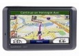
Gps review
http://www.reviewsgps.us - Most were way too technical for me! Now, please understand, I'm very comfortable with technical devices. I currently teach mathematics and computer programming. It's just that it's hard to decide if a certain model GPS device is
GPS to vCard
With this tool you can add GPS coordinates to vCards - elektronic business cards - that you have previously exported from e. g. Microsoft Outlook. Therefore the tool uses the address data contained within the vCards and adds the exact GPS position on that
Easy Survey v.1 4
Easy Survey is a software package for Microsoft Office Pro, designed for survey creation and conducting. In contrast to another survey applications, Easy Survey uses the possibilities afforded by Microsoft Access for form creation.
Frontbase GPS v.1 3
GPS Software for Garmin. Download waypoints, routes and tracks from Garmin GPS. Upload waypoints, routes and tracks to Garmin GPS. Excel and Text files supported! This software is very easy to use!

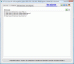
GPS Tracking v.1.0
Are you looking for a GPS tracking system or a GPS tracker but haven't found the one that is ideal for you? Then,